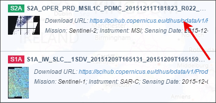
Below the product thumbnail that has the download URL. This is what you want to clip in order to download your chosen Sentinel data.
2. What’s Next?
After you download Sentinel satellite data, chances are that you are going to want to display it in the visible spectrum. This is exactly how our eyes see objects around us.
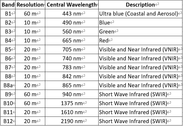
Each image is separated by its respective spectral band. See our table below for the spectral bands of Sentinel 2. Sentinel 2B will be identical to Sentinel 2A.
If you want to combine the red, green and blue channels as composite bands (such as Google Earth imagery) – read our composite bands tutorial.
…Or maybe you’d like to perform an NDVI analysis in ArcGIS or an image classification.
You now have free satellite data from Sentinel to help you.
3. What are the Spectral Bands of Sentinel 2A and 2B?
We’ve listed below, the spectral and spatial resolution of Sentinel 2A. There are 13 bands in total. Four spectral bands have a 10-meter resolution. Six bands have a 20-meter resolution. And the remaining 3 have a spatial resolution of 60 meters.
Here are the spectral band details for Sentinel 2A: