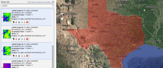
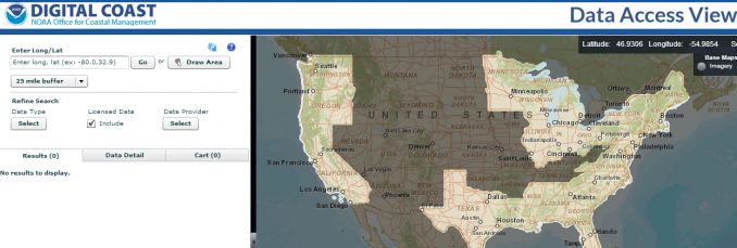
First, enter your search criteria (KML, coordinates, etc.). Next, select the checkbox for LiDAR in the data sets tab. Finally, click the results tab to see what LiDAR datasets are available.
- Search for LiDAR data with a user-friendly state-of-the-art interface
- Filter searches by time and set region of interests in map by predefined areas and coordinates
Also, USGS Earth Explorer sits on top of our 15 free satellite data sources, so it’s definitely worth your time to know it inside out.